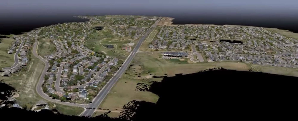
Roxborough Park Subdivision
Douglas County, CO
740 acres
USE: IRRIGATION IMPROVEMENTS
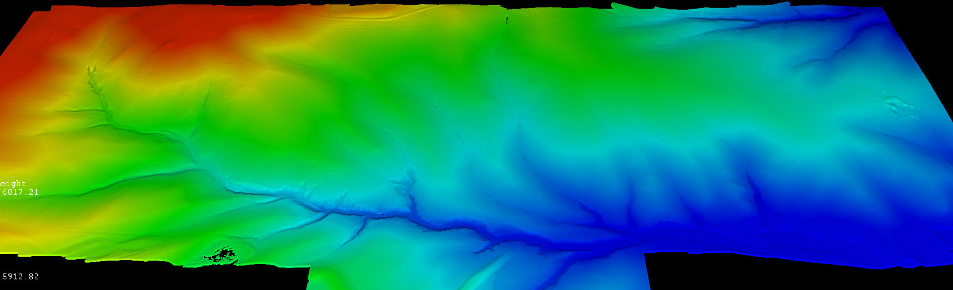
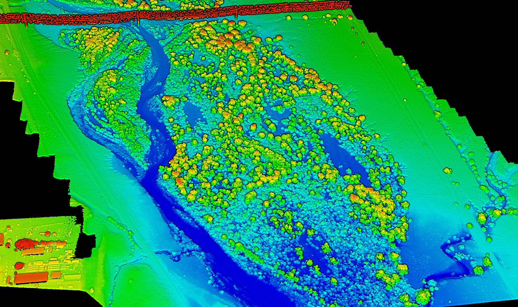
Magnuson Property
Briggsdale, CO
500 acres
USE: CIVIL PLANS FOR NEW DEVELOPMENT
X
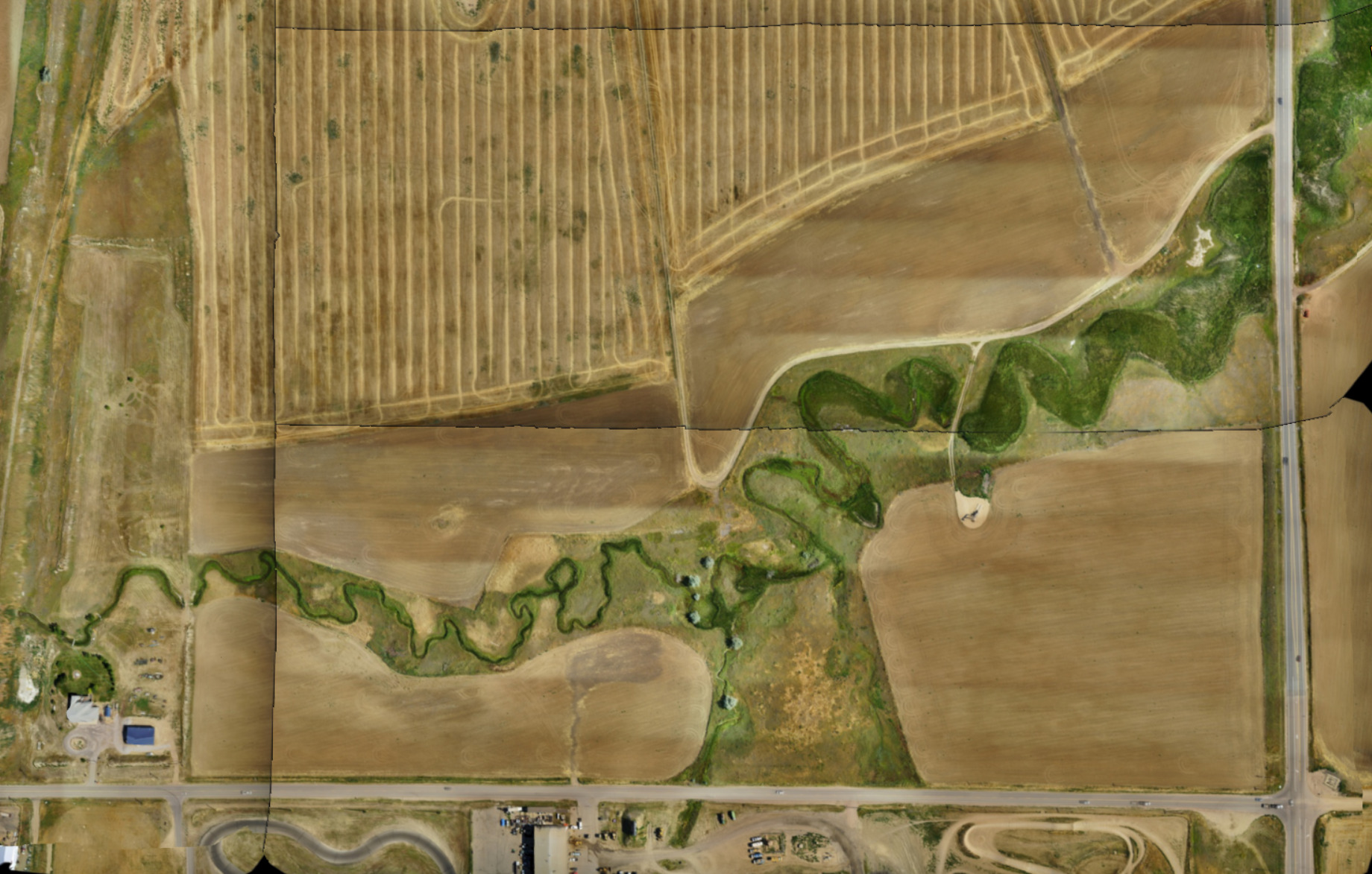
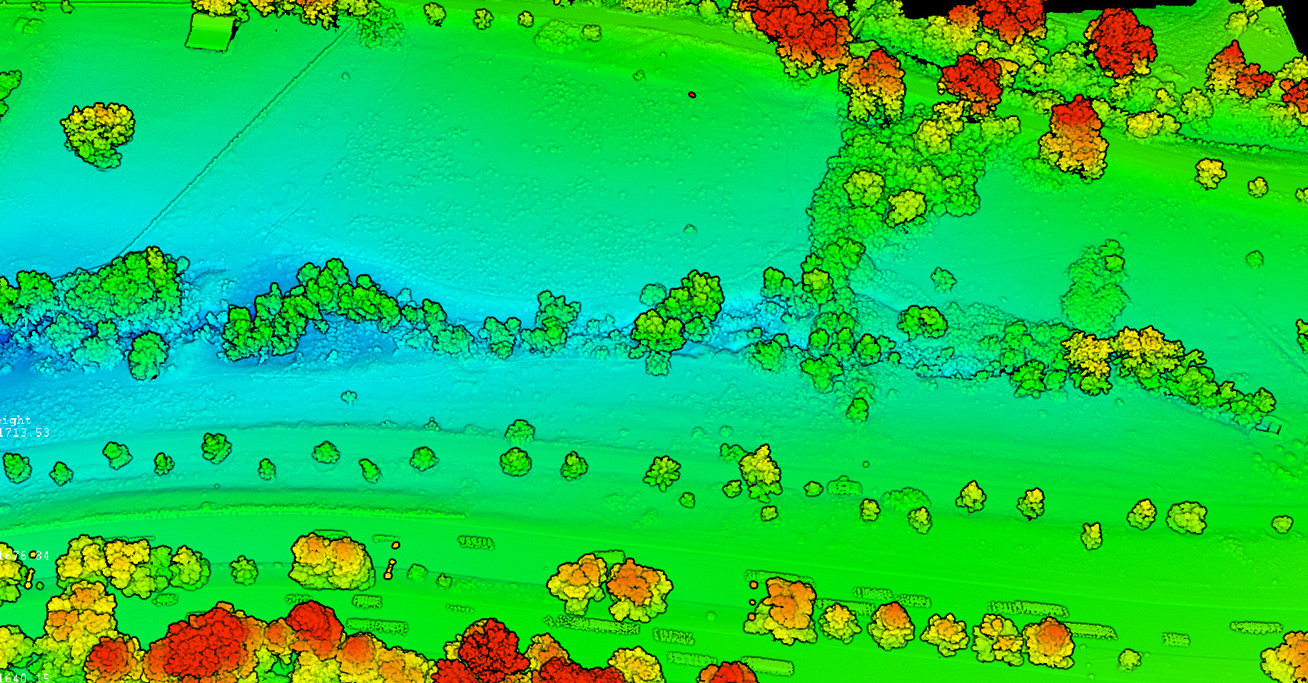
Magnuson Property
Location: Briggsdale, CO
Area = 500 acres
Data: Topography, LiDAR
Use: Civil Plans for new development
Stella Property
Bennett, CO
350 acres
USE: CIVIL PLANS FOR NEW DEVELOPMENT
X
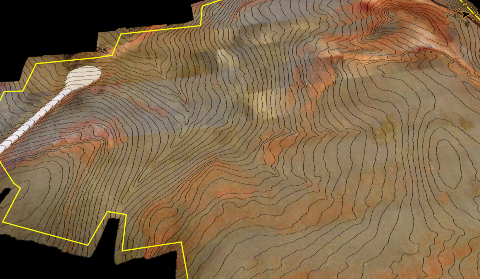
Stella Property
Location: Bennett, CO
Area = 350 acres
Data: Topography and imagery, LiDAR & photogrammetry
Use: Civil Plans for new development
Quincy Property
Arapahoe County, CO
350 acres
USE: CIVIL PLANS FOR NEW DEVELOPMENT
X
Quincy Property
Location: Arapahoe County, CO
Area = 350 acres
Data: Topography and imagery, LiDAR & photogrammetry
Use: Civil Plans for new development
Dacono Estates
Dacono, CO
300 acres
USE: CIVIL PLANS FOR NEW DEVELOPMENT
X
Dacono Estates
Location: Dacono, CO
Area = 300 acres
Data: Topography and imagery, LiDAR & photogrammetry
Use: Civil Plans for new development
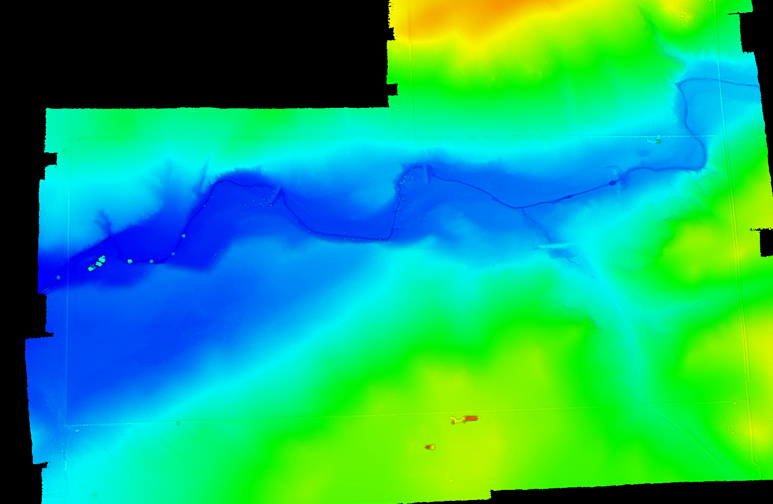
Pueblo Floodplain
Pueblo, CO
300 acres
USE: FLOODPLAIN MODELING
X
Pueblo Floodplain
Location: Pueblo CO
Area = 300 acres
Data: Topography and imagery, LiDAR & photogrammetry
Use: Floodplain modeling
Branam Ranch
Escambia County, FL
200 acres
USE: CIVIL PLANS FOR NEW DEVELOPMENT
X
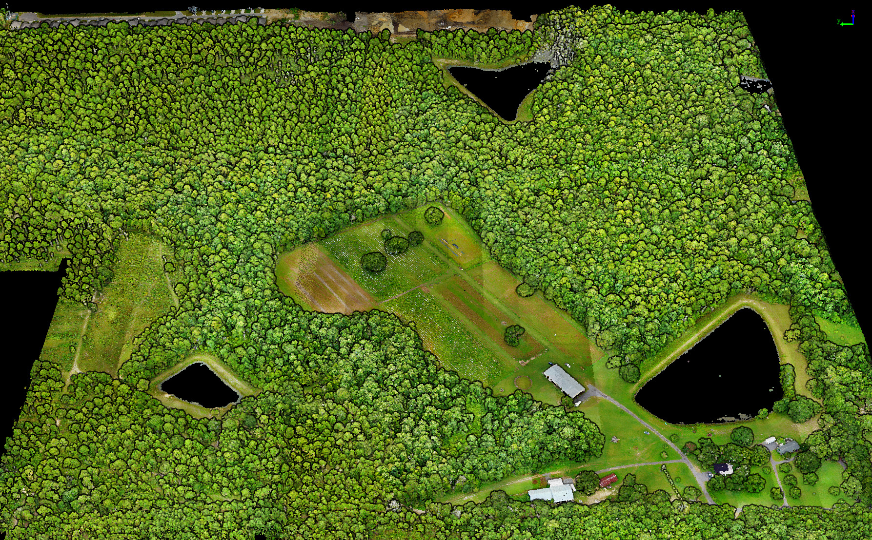
Branam Ranch
Escambia County, FL
Area = 200 acres
Data: Topography and imagery, LiDAR & photogrammetry
Use: Civil Plans for new development
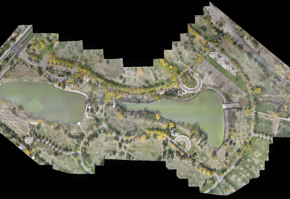
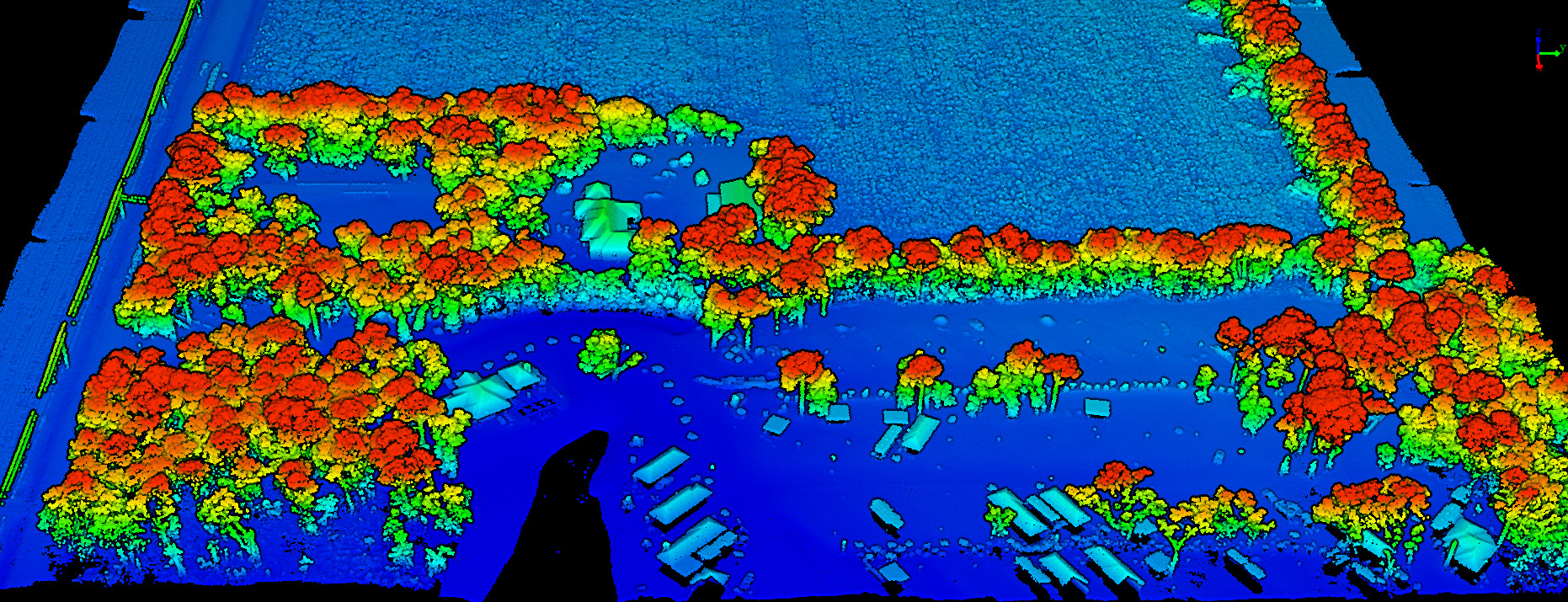
Florida State Parks
FDEP Various Locations, FL
100-200 acres
USE: PARK RESTORATION PLANS DUE TO HURRICANE DAMAGE
X
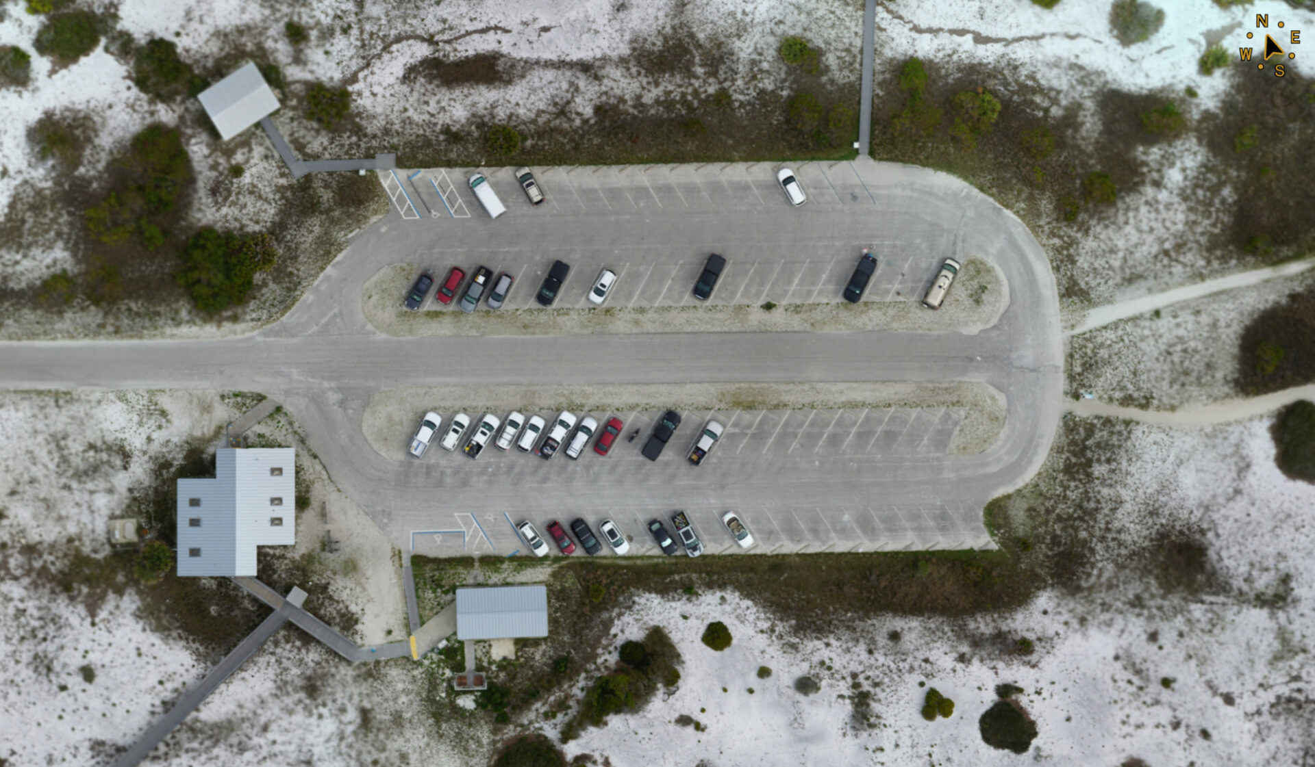
Florida State Parks, FDEP
Various locations, FL
Area = 100-200 acres
Data: Topography and imagery, LiDAR & photogrammetry
Use: Park restoration plans due to hurricane damage
E1/2 of the SW1/4 of S24 / T6N / R65W
Weld County, CO
100 acres
USE: CIVIL PLANS FOR NEW DEVELOPMENT
X
E1/2 of the SW1/4 of S24 / T6N / R65W
Location: Weld County, CO
Area = 100 acres
Data: Topography and imagery, LiDAR & photogrammetry
Use: Civil Plans for new development
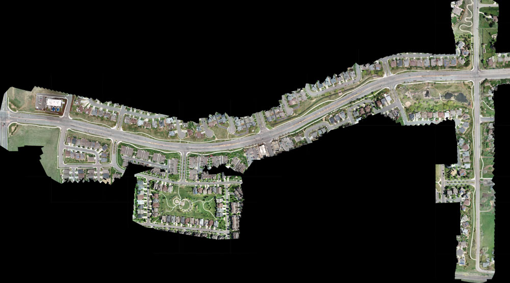
Speer Boulevard
Denver, CO
2 mile corridor
USE: IRRIGATION IMPROVEMENTS
X
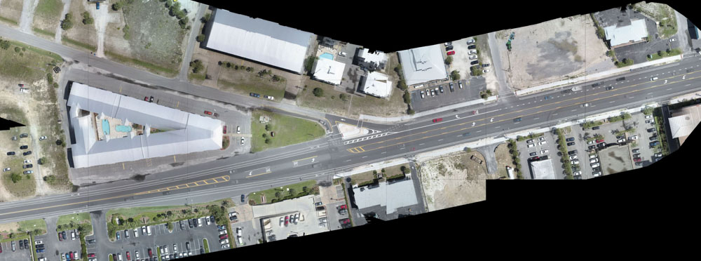
Speer Boulevard
Location: Denver, CO
Area = 2 mile roadway corridor
Data: Topography and imagery, LiDAR & photogrammetry
Use: Irrigation improvements
West Lagoon Blvd
Gulf Shores, CO
100 acres
USE: ROADWAY IMPROVEMENTS
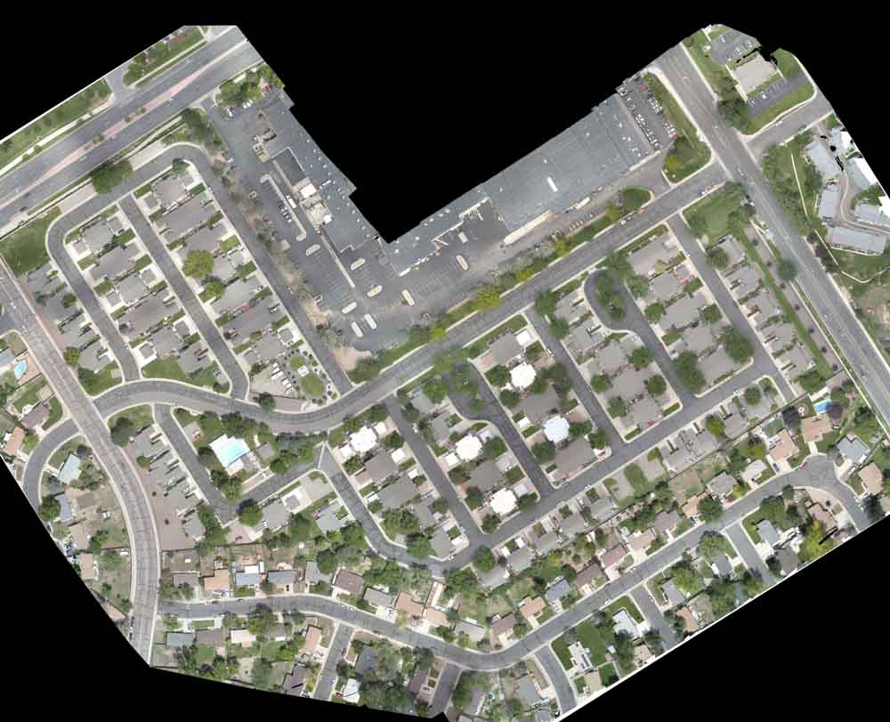
Village of Five Parks Subdivision
Arvada, CO
70 acres
USE: IRRIGATION IMPROVEMENTS
Fort Logan Cemetery
Denver, CO
60 acres
USE: DRAINAGE STUDY
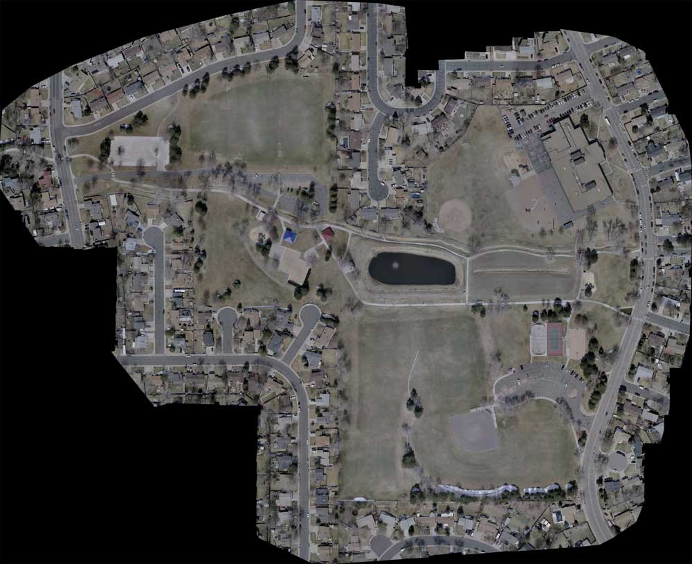
Woodglen Park
Thornton, CO
60 acres
IRRIGATION IMPROVEMENTS
Higbee Farm
Baldwin County, AL
50 acres
USE: CIVIL PLANS FOR NEW DEVELOPMENT
X
Higbee Farm
Baldwin County, AL
Area = 50 acres
Data: Topography and imagery, LiDAR & photogrammetry
Use: Civil Plans for new development
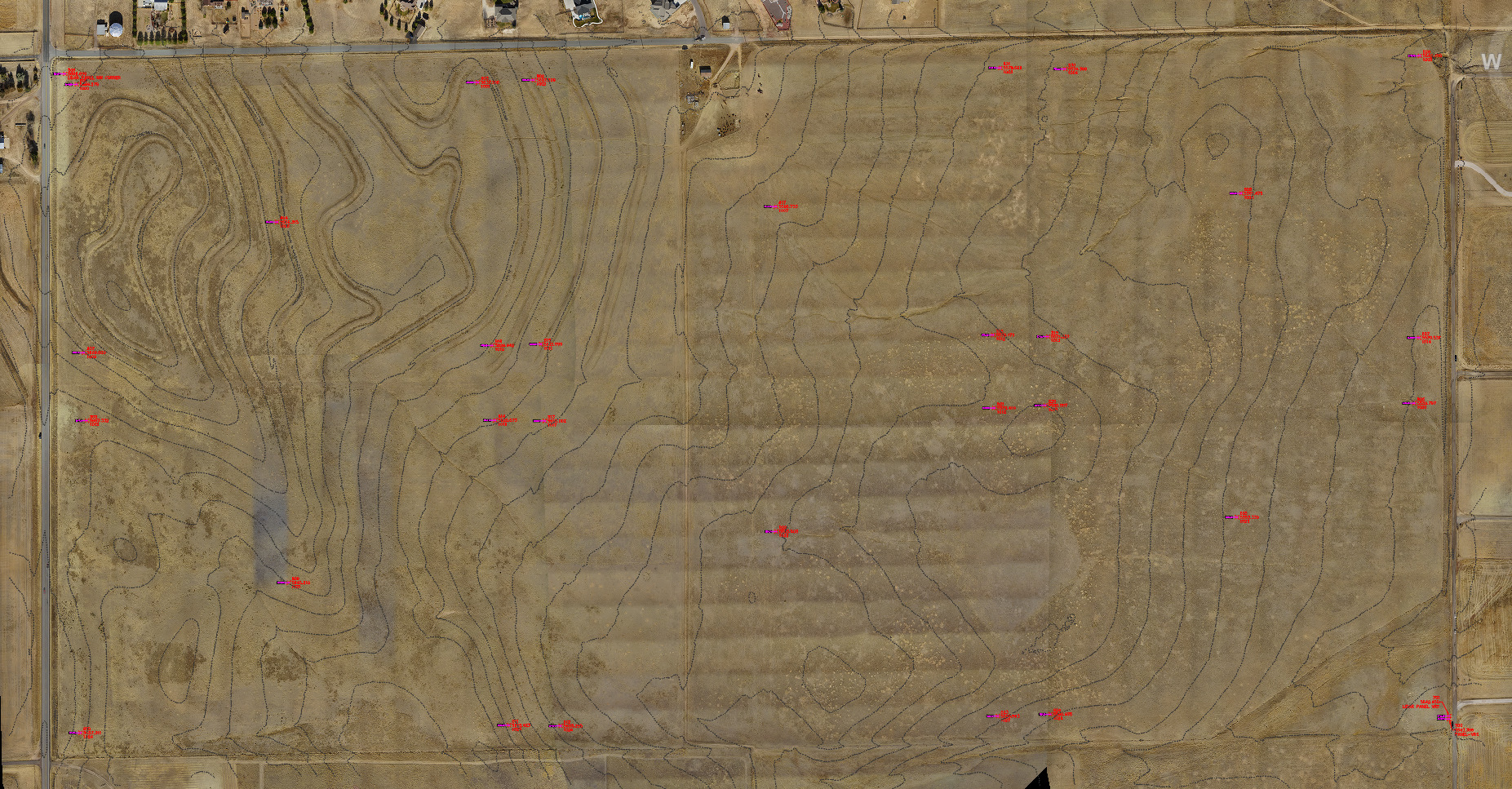
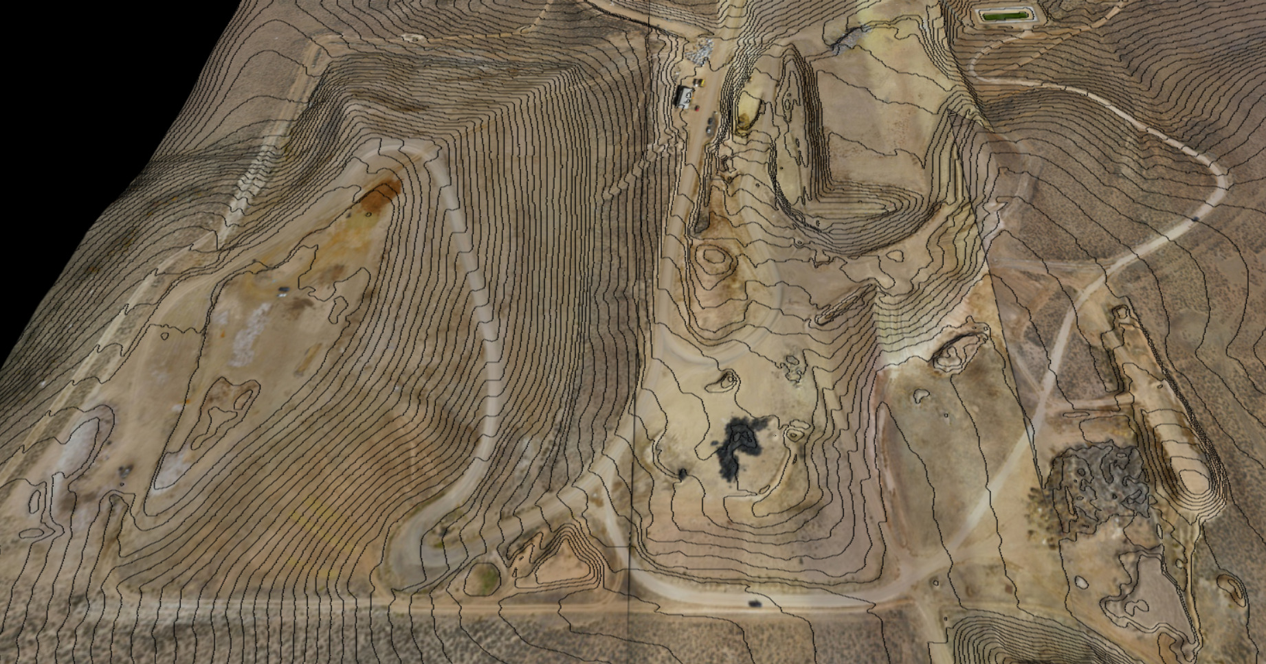
Gunnison County Landfill
Gunnison, CO
50 acres
USE: VOLUME CALCULATIONS
X
Gunnison County Landfill
Location: Gunnison, CO
Area = 50 acres
Data: Topography, LiDAR
Use: Volume calculations
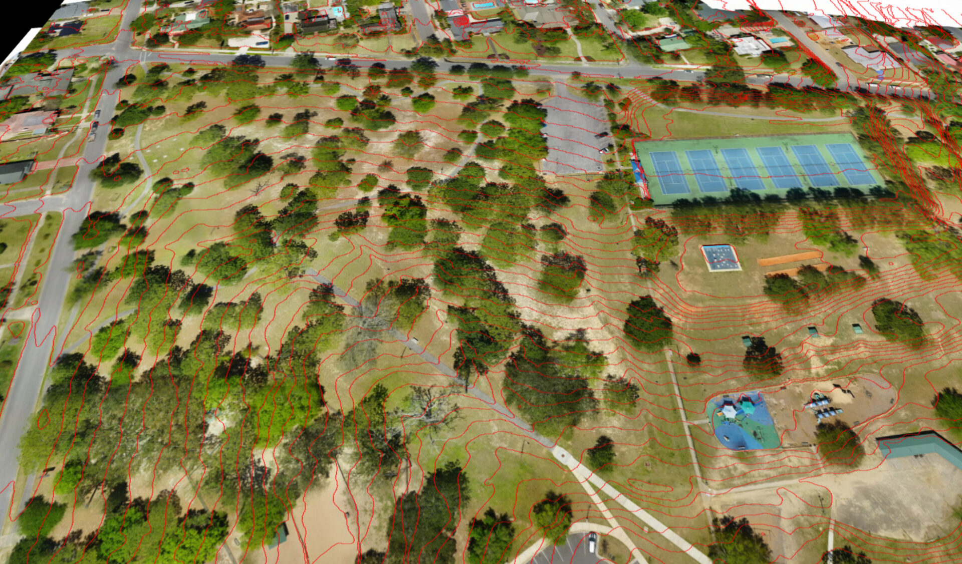
Bayview Park
Pensacola, FL
50 acres
USE: PARK IMPROVEMENT PLANS
X
Bayview Park
Location: Pensacola, FL
Area = 50 acres
Data: Topography and imagery, LiDAR & photogrammetry
Use: Park improvement plans
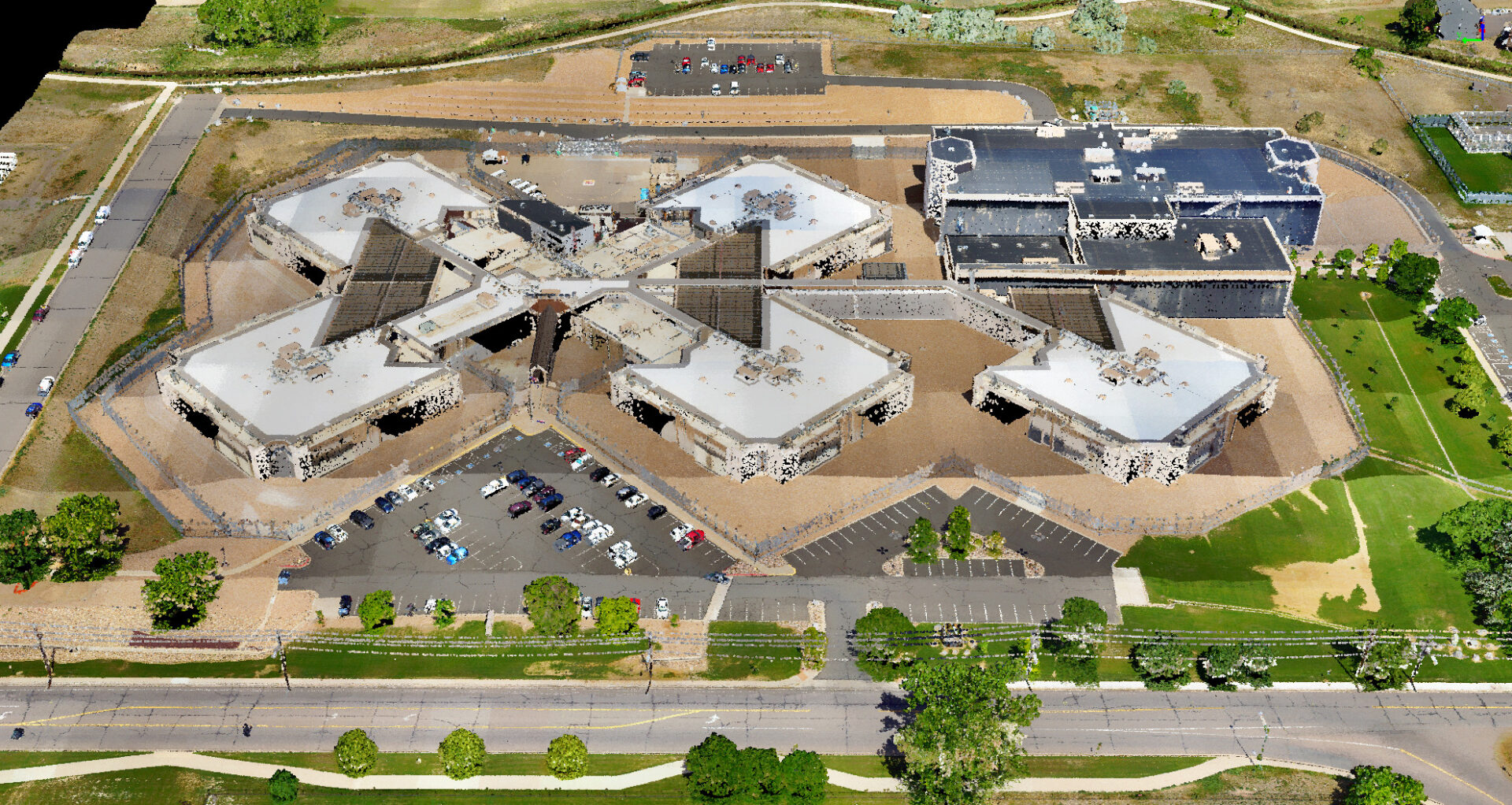
Adams County Detention Facility
Adams County, CO
50 acres
USE: STORMWATER PLANS
X
Adams County Detention Facility
Location: Adams County, CO
Area = 50 acres
Data: Topography and imagery, LiDAR & photogrammetry
Use: Stormwater Plans
Baldwin RV Park
Robertsdale, AL
40 acres
USE: CIVIL PLANS FOR NEW DEVELOPMENT
X
Baldwin RV Park
Robertsdale, AL
Area = 40 acres
Data: Topography and imagery, LiDAR & photogrammetry
Use: Civil Plans for new development
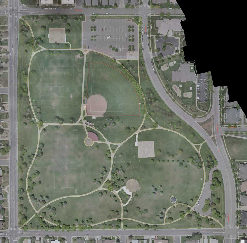
Fred Thomas Park
Denver, CO
40 acres
USE: IRRIGATION IMPROVEMENTS
Baars Park
Pensacola FL
40 acres
USE: PARK IMPROVEMENT PLANS
Woodglen Square Subdivision
Thornton CO
40 acres
USE: IRRIGATION IMPROVEMENTS
Keller Road
Robertsdale, AL
35 acres
USE: CIVIL PLANS FOR NEW DEVELOPMENT
X
Keller Road
Robertsdale, AL
Area = 35 acres
Data: Topography and imagery, LiDAR & photogrammetry
Use: Civil Plans for new development
Jackass Gulch
Littleton, CO
35 acres
FLOODPLAIN MODELING, EROSION PREVENTION PLANS
X
Jackass Gulch
Location: Littleton, CO
Area = 35 acres
Data: Topography and imagery, LiDAR & photogrammetry
Use: Floodplain modeling, Erosion Prevention Plans
Harmon Property
Livermore, CO
35 acres
USE: GRADING PLANS FOR HOUSE & DRIVEWAY
X
Harmon Property
Location: Livermore, CO
Area = 35 acres
Data: Topography and imagery, LiDAR & photogrammetry
Use: Grading Plans for house & driveway
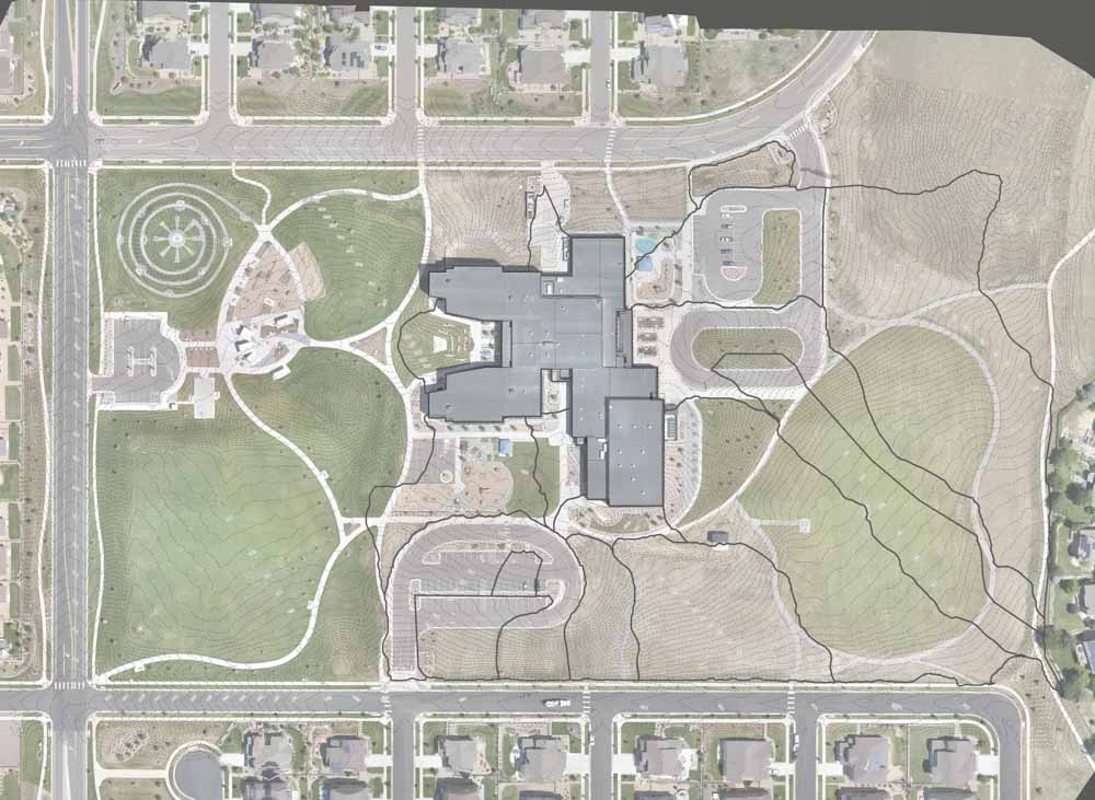
Meadowlark School
Erie CO
22 acres
USE: DRAINAGE STUDY
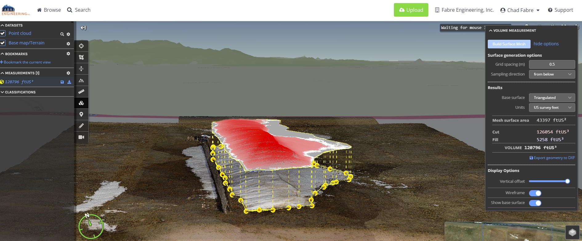
Wyoming Snow Fence
Erie CO
22 acres
USE: SNOW VOLUME CALCULATIONS
X
Wyoming Snow Fence
Location: Cheyenne, WY
Area = 10 acres
Data: Topography, LiDAR
Use: Snow volume calculations
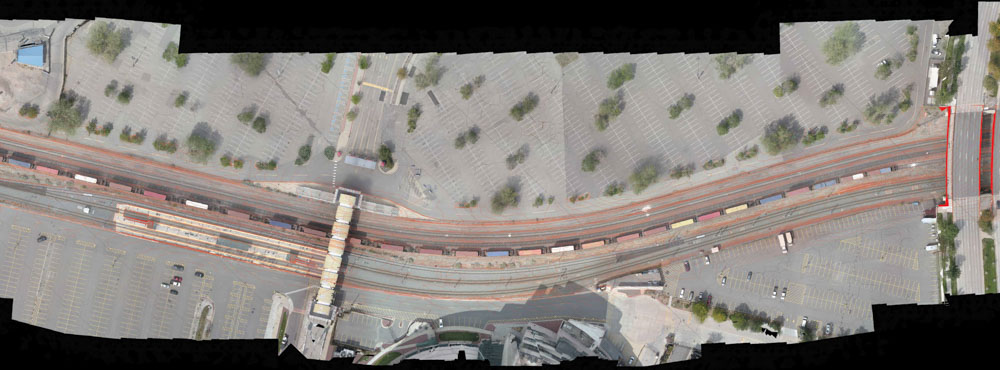
CML Railroad
Denver CO
10 acres
USE: DRAINAGE STUDY
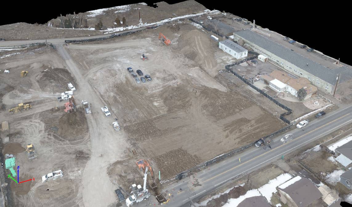
West Line Village Apartments
Lakewood CO
5 acres
USE: CONSTRUCTION EARTHWORK VOLUME ANALYSIS
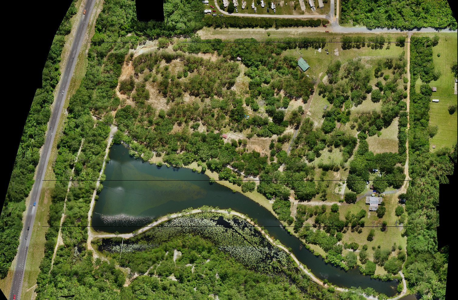
Hurst Hammock
Pensacola, FL
1.3 mile corridor
USE: UTILITY IMPROVEMENTS