Phone number: 720.903.0048

UAV Surveying

Go Back to Services
UAV-SurveyingUAV-Surveying

Fabre Engineering has been using UAV aerial mapping & surveying since 2017 to enhance our civil engineering design. We now offer standalone UAV mapping & surveying services using advanced UAV technology and software. Our drones use high accuracy PPK GPS systems that deliver 0.1’ to 0.2’ vertical accuracy.

LIDAR and photogrammetry solutions are available. LIDAR is used for sites with trees and vegetation.

The aerial orthophoto is a straight-down view of the site. It is a high resolution aerial photo that provides excellent detail for use in survey, planning, engineering, and construction. We consider it an essential part of almost every civil engineering workflow.

Request a Quote

Fabre-Engineering-UAV-Surveying-Projects-01Fabre-Engineering-UAV-Surveying-Projects-01

Services include

  • Aerial Data collection
  • Topographic Surveys
  • GIS Mapping
  • Software processing to create orthomosaic aerial image
  • 3D point cloud
  • Translation to new or existing survey coordinates

Sites up to 200 acres can be done. Larger sites possible – contact Fabre Engineering for details.

FAA Part 107 Certified

Markets

  • Land development, AEC
  • Oil & Gas
  • Transmission Line
  • Utilities
  • Transportation
  • Municipal & Government
  • Construction
  • Mining
  • Irrigation & Landscape Design
Fabre-Engineering-UAV-Surveying-Projects-03Fabre-Engineering-UAV-Surveying-Projects-03

Deliverables

  • Photogrammetry and LIDAR solutions
  • Civil 3D Surface
  • High Density Point Cloud
  • Aerial orthophoto
Fabre-Engineering-UAV-Surveying-Projects-04Fabre-Engineering-UAV-Surveying-Projects-04

Clients and Agencies served

  • Denver Parks and Recreation
  • KDI Hydrosystems
  • Calibre Engineering
  • Martines Palmeiro Construction, LLC
  • City of Thornton
  • City of Gulf Shores
  • Boulder Valley School District
  • Rimkus Consulting Group Inc.
  • Caplan & Earnest
  • Roxborough Village Metro District
  • Woodglen Square HOA
  • Village of Five Parks HOA
  • Godden Sudik Architects inc.
  • Pivotal Architecture

UAV Aerial Surveying & Mapping, LiDAR & Photogrammetry

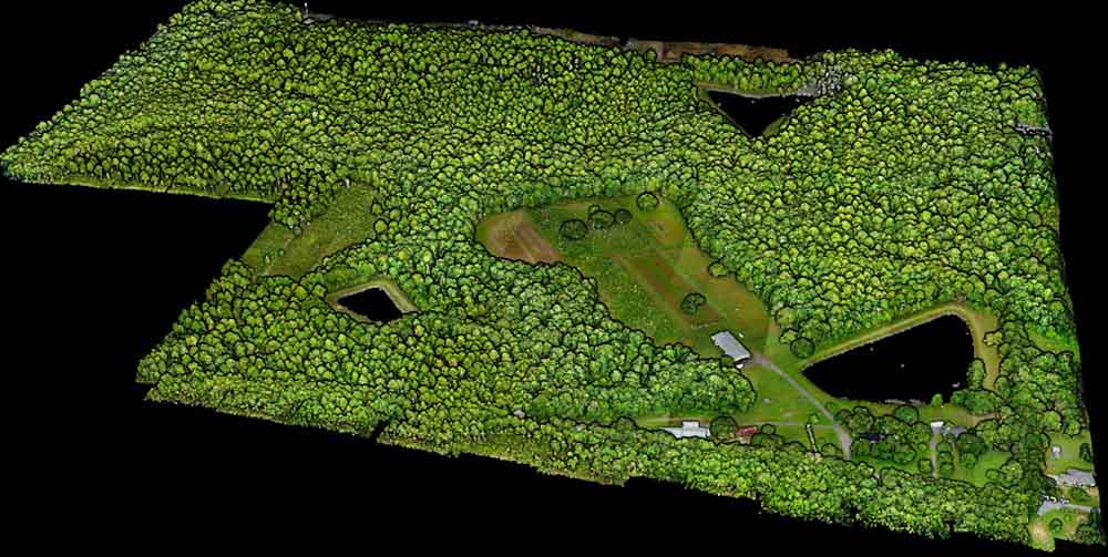
Fabre Engineering has been providing UAV aerial mapping & surveying since 2017. We offer both LiDAR & photogrammetry solutions, capable of providing up to 0.1’ vertical accuracy.

Projects have included large 500+ ac sites, roadway corridors, railway corridors, parks, schools, cemeteries, drainageways, and steep mountain areas.

The resulting imagery and surface data can be delivered in a lightweight Autocad/Civil 3D file, or format of the Client’s choosing (3d point cloud, DSM, DTM, etc).