
DRONE (UAV) SURVEYING PROVIDERS & CONSULTANTS
LiDAR & Photogrammetry | Quadcopter & Fixed Wing |
Experienced, Professional, Certified, Insured
LiDAR & Photogrammetry | Quadcopter & Fixed Wing |
Experienced, Professional, Certified, Insured
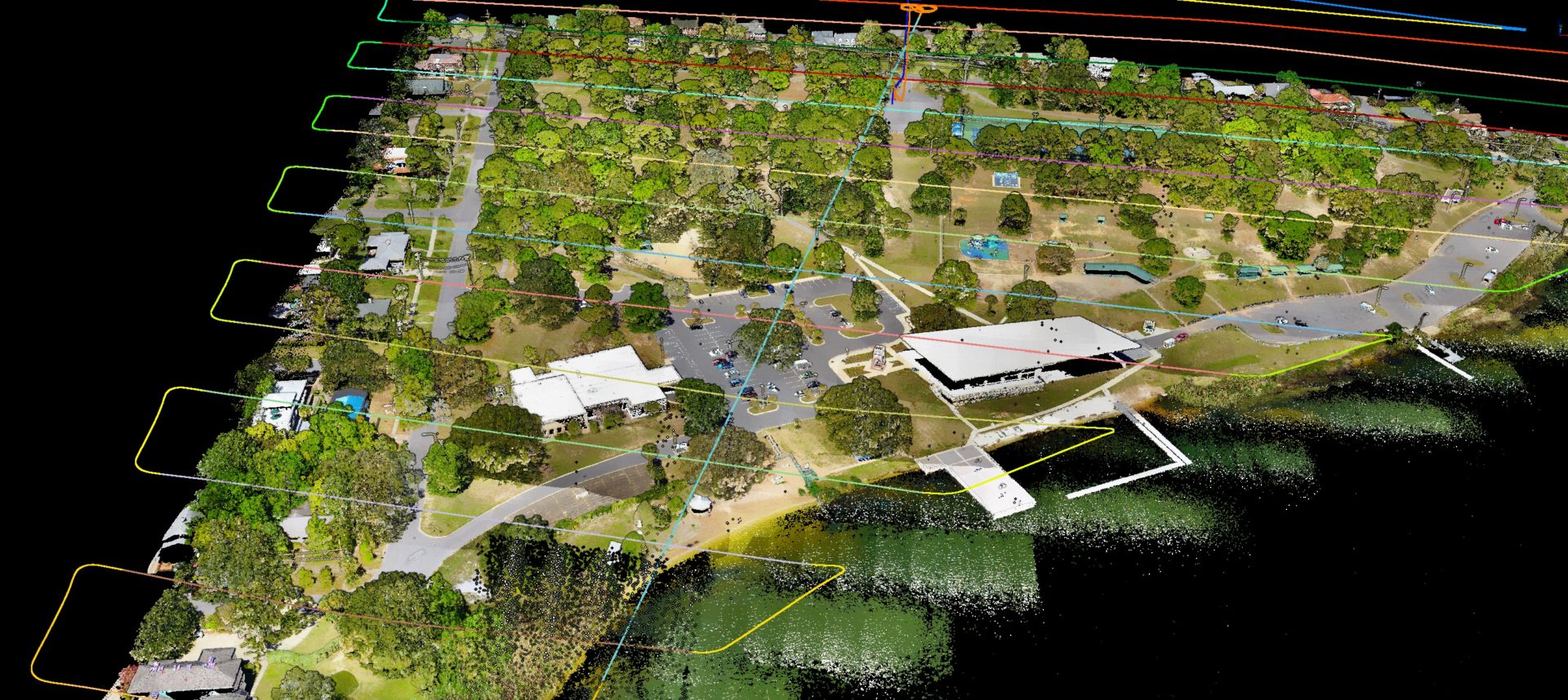
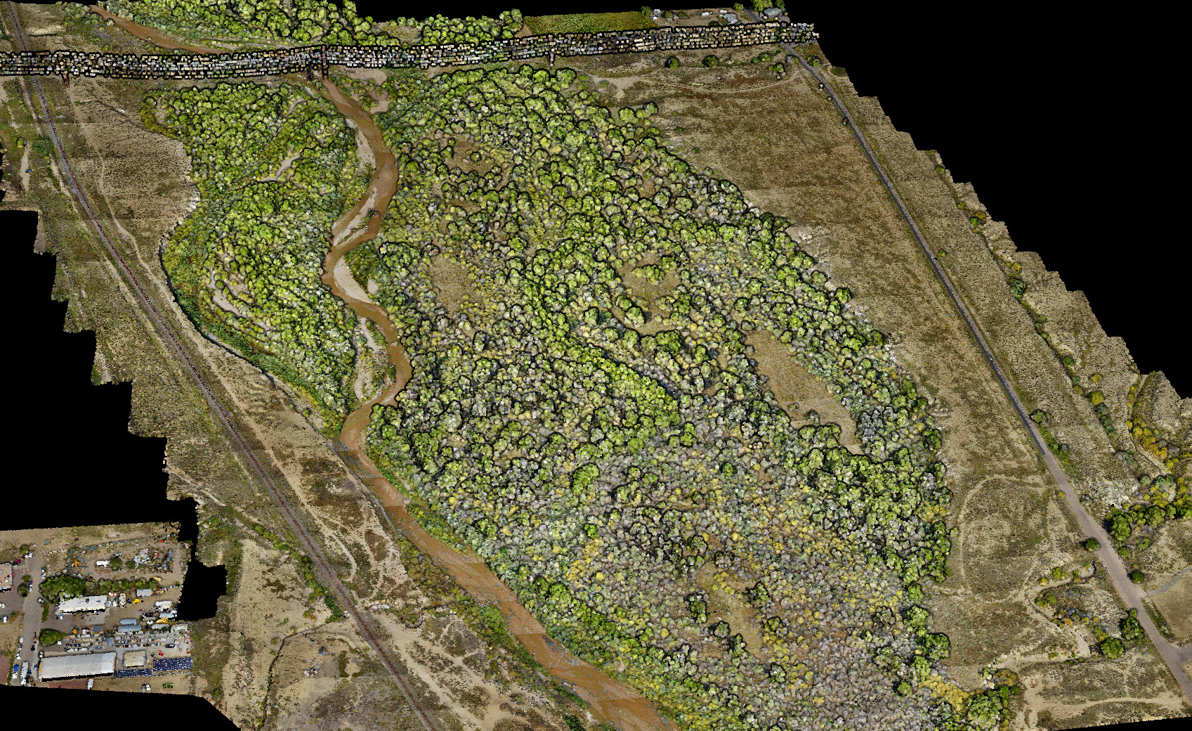
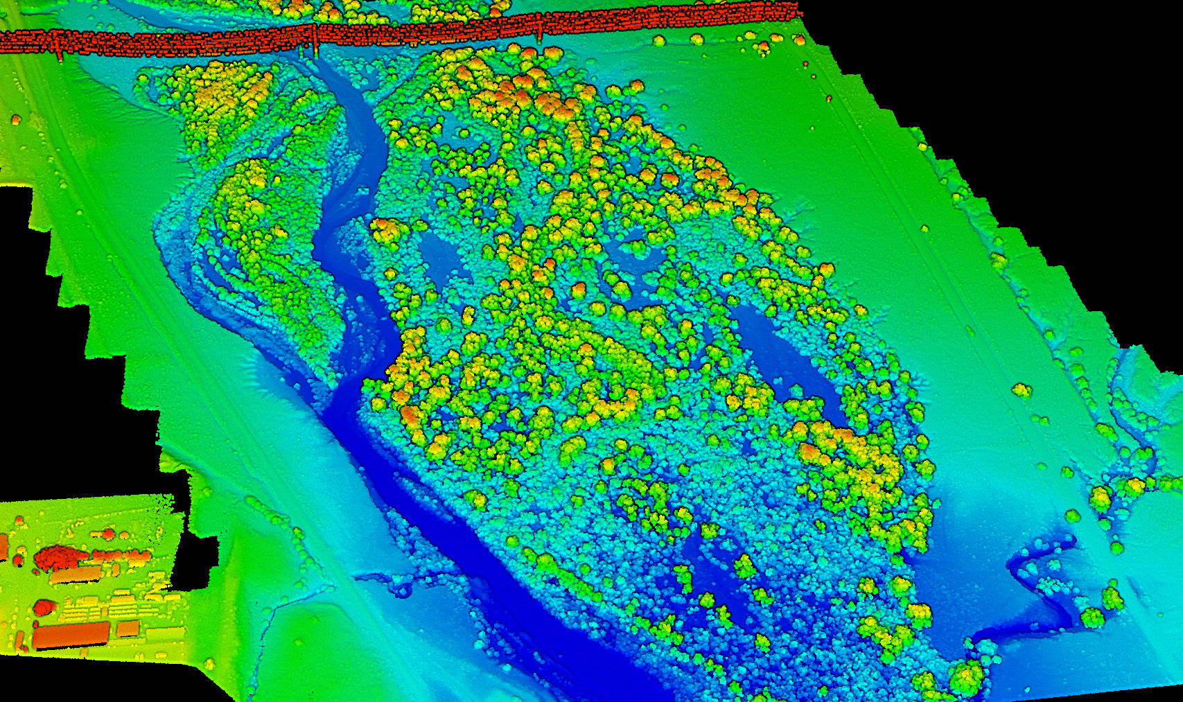
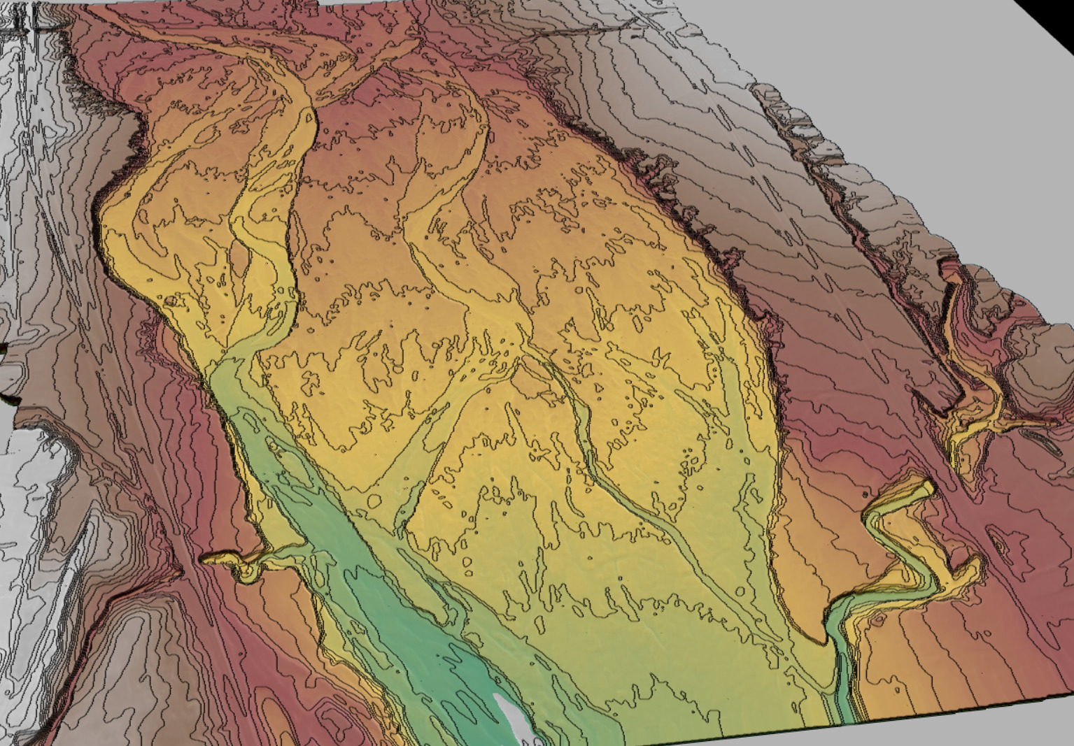
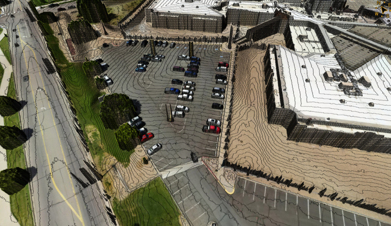
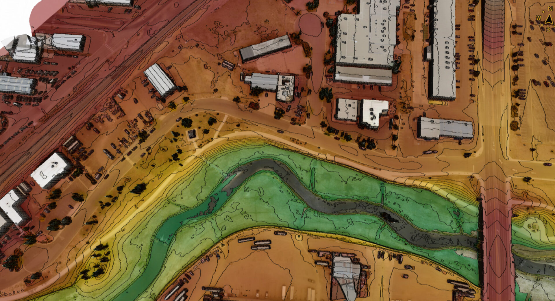
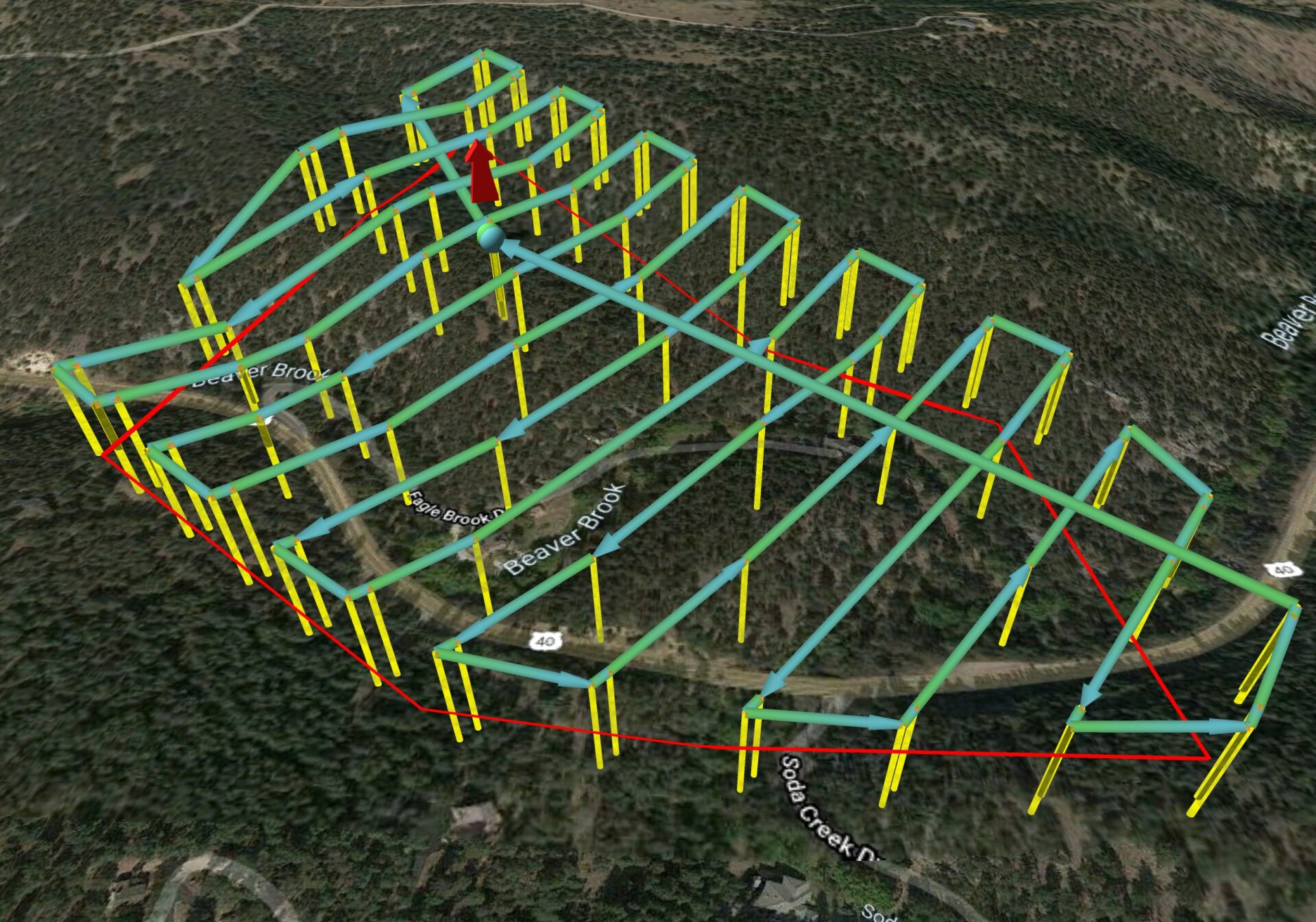
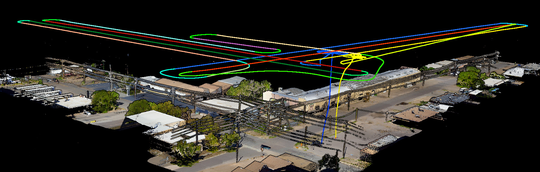
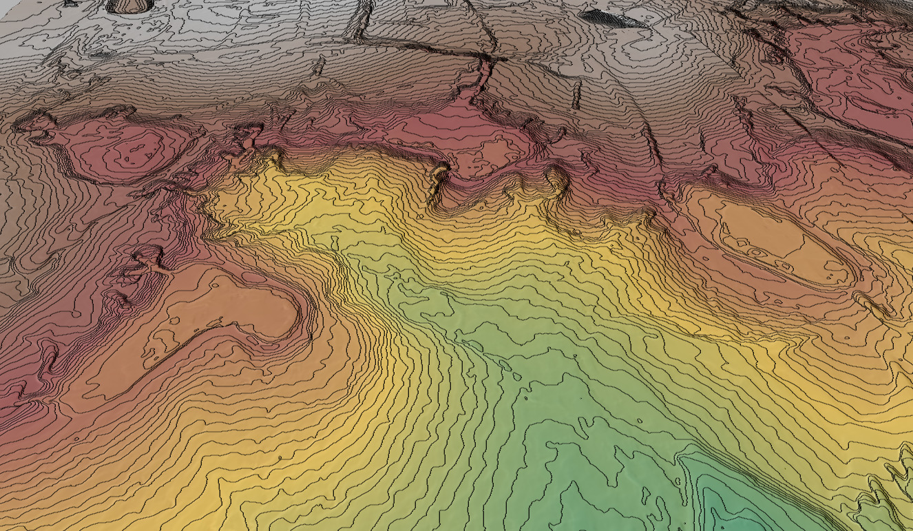
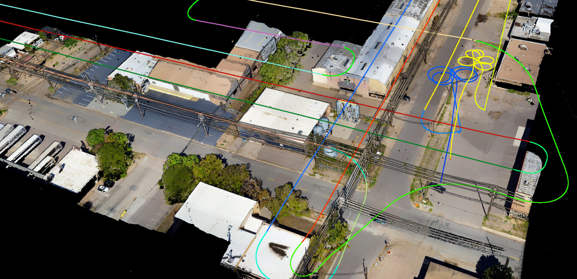
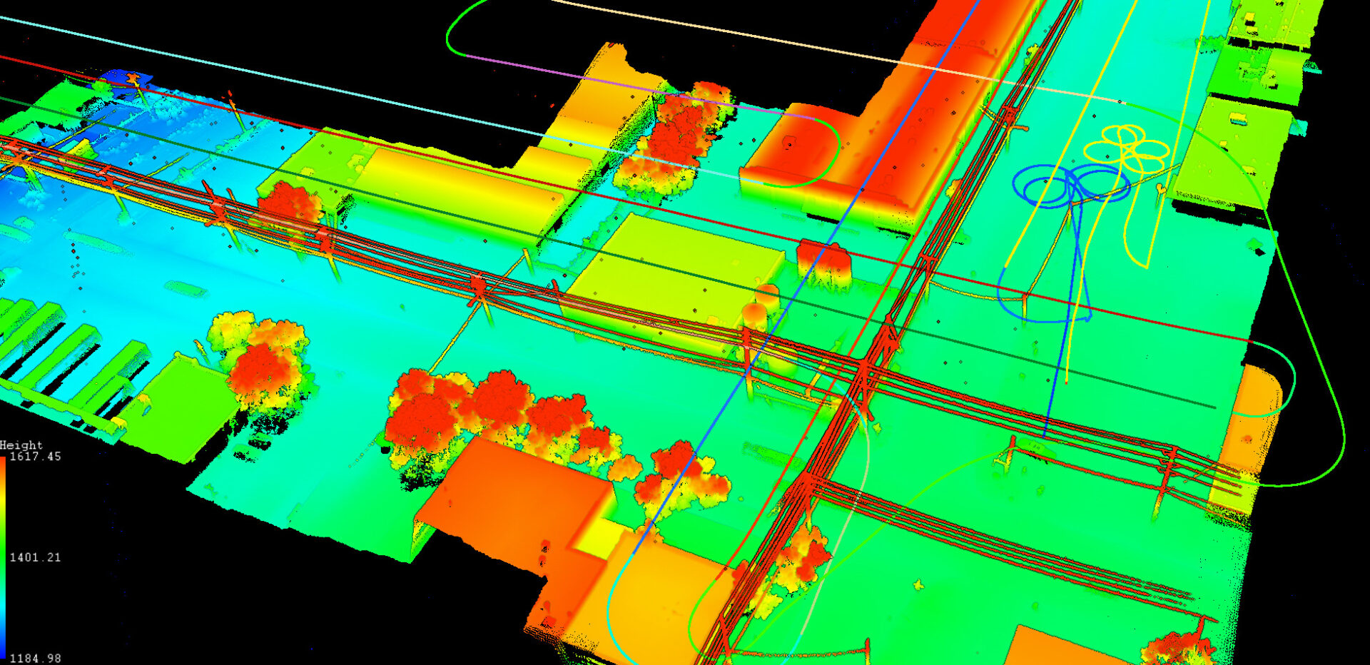
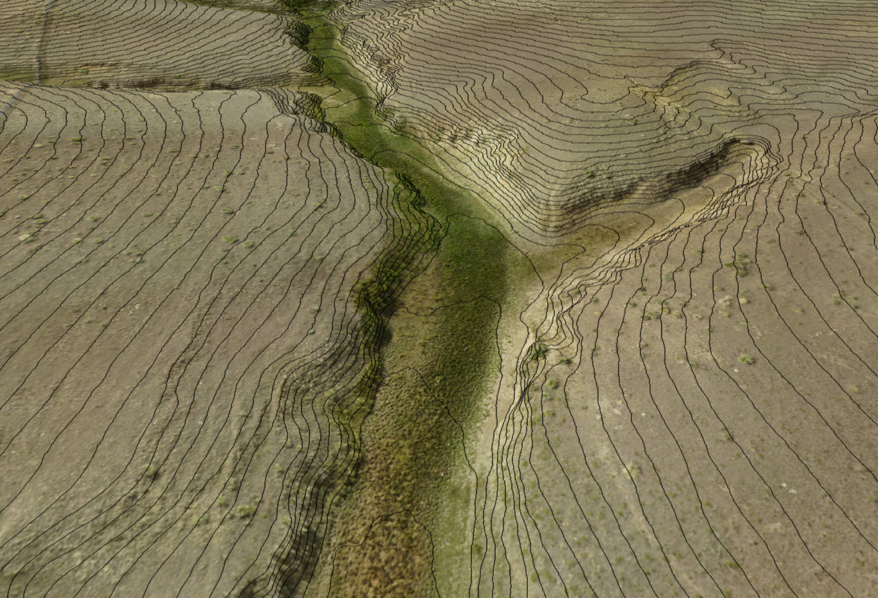
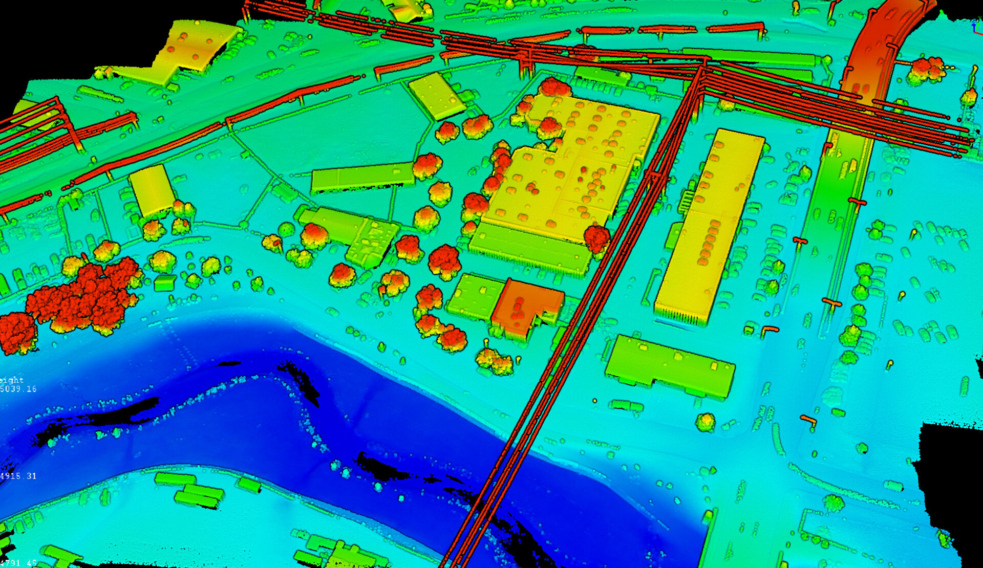
Fabre Engineering & UAV Surveying offers UAV aerial mapping & surveying since 2017 using LiDAR and photogrammetry. Our drones use high-accuracy PPK GPS systems that deliver 0.1′ to 0.2′ vertical accuracy. LiDAR is used for sites with trees and vegetation. Fabre Engineering has provided drone surveys in Colorado, Florida, Alabama, and Wyoming.
LEARN MOREREQUEST QUOTEFabre Engineering Inc. specializes in roadway, drainage, utilities, and land development engineering/site design. Our focus is always on achieving the best practical solutions by considering costs, constructibility, schedule, appearance, and approvability. We use the latest industry design tools to achieve optimum accuracy and efficiency. All projects are designed, engineered, and managed by senior level P.E.s.
LEARN MOREFabre Engineering is a great option for the Survey or Engineering companies that are not ready to invest time and money into everything needed to perform accurate drone surveying. We have the training, experience, certifications, equipment, hardware, and software needed to deliver survey-grade topographic surveys and aerial imagery. Fabre Engineering has been providing drone / UAV surveying since 2017.
LEARN MORE
